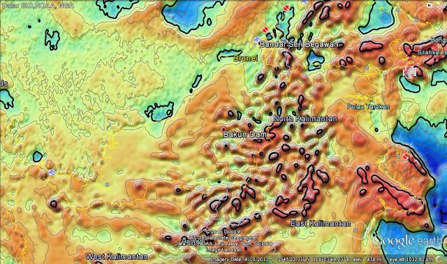
After Kinabalu, Bakun Dam? The likelihood of an earthquake hitting Bakun suddenly seems very real........
Nude mountain climbers and angry spirits aside, East Malaysia has been for a very long time prone to tremors and earthquakes The gravity anomaly image above encompassing Sabah and Sarawak suggests that there is a significant area where a low gravity (blue) area collides with a high gravity (darker colour) region.Studies suggest that earthquakes are more likely in low gravity zones, and it should not be assumed that the normal laws of geophysics do not apply to Malaysia. As the Borneo Post story copied below shows, there are a number of major fault lines that cut across Sarawak, and any movement of the Earth's crust has the potential to activate those faults.
KUCHING: A seismotectonic map showing earthquake fault lines in Sarawak drawn up in 2006 by Minerals and Geoscience Department in Sabah shows the site of the proposed Baram Dam is in the close vicinity of two fault lines.
This was disclosed by Alexander Yan the former director of Minerals and Geoscience department to The Borneo Post in Kota Kinabalu on Monday on the sidelines of a briefing on the recent earthquake in Kundasang/Ranau which claimed 18 lives.


Comments
Post a Comment